Long Patagonian Circuit
The Patagonian territory is crossed from North to South by two long routes which pass through most of the main tourist attractions of the region. We are talking about Route Nº 3 and Route Nº 40, the two vertical axes which allow travelers who have their own vehicles to perform a circular trip going from North to South along one of the routes and in the opposite direction through the other. In order to be able to enjoy this journey properly, we recommend at least 20 days, which will be enough to visit the most traditional destinations of the Patagonia. If travelers wish to know other destinations and tourist attractions in more depth, they will need a greater number of days. The ideal time to do this trip is between October and April, since, during the rest of the year, driving on the roads will be probably hampered due to ice and snow. If the traveler arrives from a national destination outside of the Patagonia – whichever the direction of the trip – they will cross the province of La Pampa, where they may stop to rest and enjoy the attractions related to rural, cultural and natural tourism. If the trip takes place in March or April, they will be able to witness a unique natural event: deer watching during rutting, which can be done at Parque Luro, at 35 km from Santa Rosa, capital city of the province.
Route Nº 40
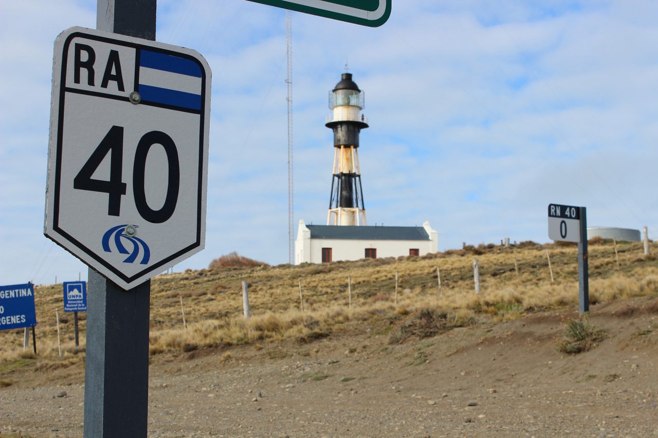
The mythical Route Nº 40, the longest and most visually spectacular road of Argentina, begins in Patagonia, to be more precise, in Cabo Vírgenes, at the southern point of the province of Santa Cruz. That is the beginning of a path that – parallel to the Andes – crosses 2700 km of Patagonian territory, then going towards the northern parts of the country, with a total length of 5000 km.
During the trip, the traveler will have the privilege of meeting majestic sceneries including millennial forests, imposing glaciers, crystal clear lakes, and mysteries related to dinosaurs, native cultures, numerous national parks and World Heritage sites.
The Journey
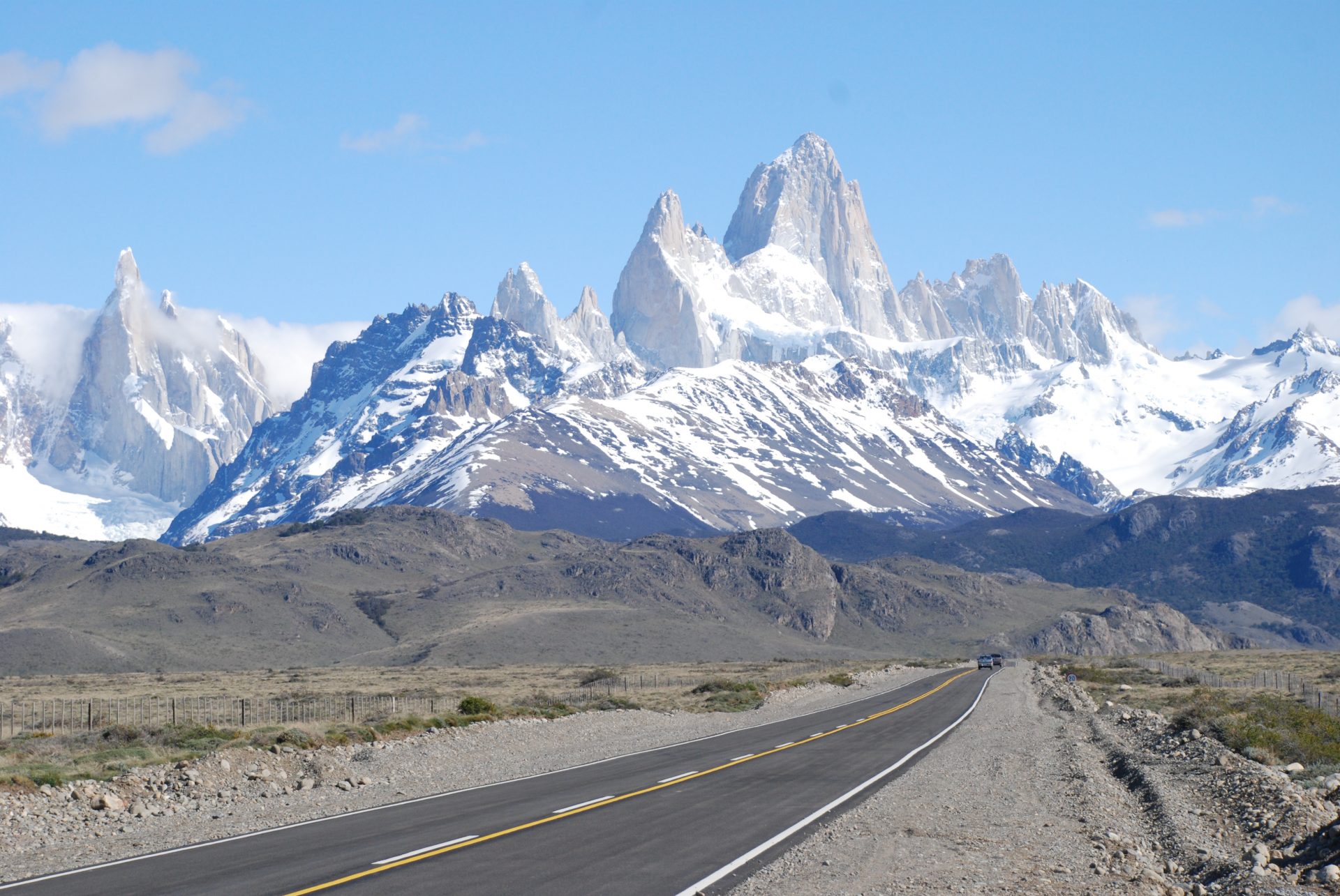
From its start, the route goes towards National Route Nº 3 (which leads to Río Gallegos); the following stretch goes deep into the province for 261 km until reaching Turbio river on the Andes. From there, it goes towards Tres Lagos, with crossroads with Provincial Routes Nº 11 and 23, gateways to El Calafate – home to the Perito Moreno Glacier, at 110 km from National Route Nº 40, which was declared a World Heritage Site by the UNESCO – and El Chaltén, a mountain town known as the national capital of trekking.
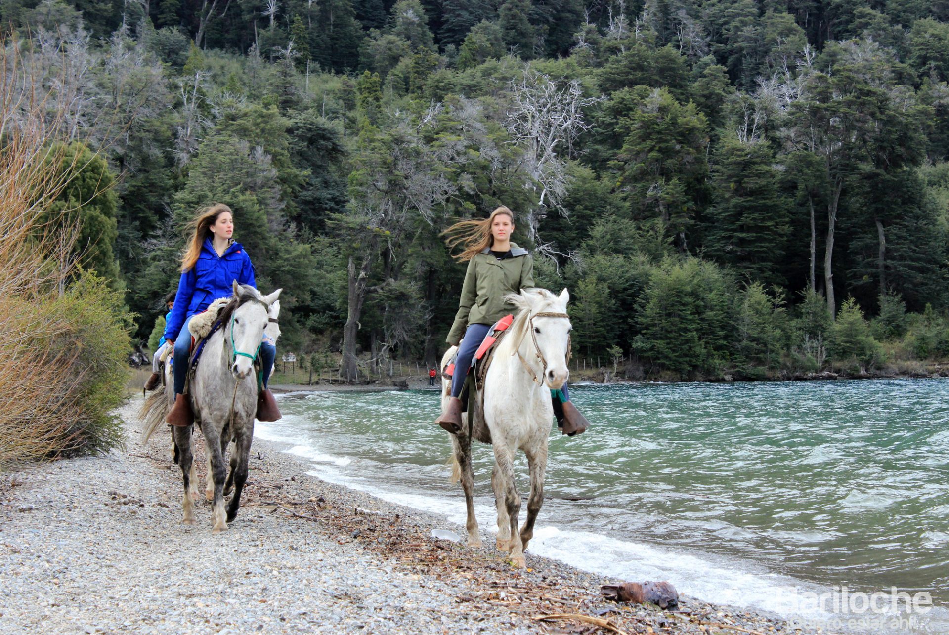
After Tres Lagos, the road moves away from the Andes, visiting Gobernador Gregores and then reaching the town of Perito Moreno. The following 250 km are of gravel road, after which there are 200 km more made of tarmac. On this part of the route, there are the entrances to the town of Los Antiguos, the Perito Moreno National Park and the Cueva de las Manos (World Heritage Site). The latter of the three, located on the Pinturas River, is a cave holding abstract and naturist pictograms painted by the Tehuelche tribe that inhabited that area of the Patagonia. Towards the north, once within the borders of the province of Chubut, National Route Nº 40 goes through the towns of Esquel and Trevelin, both of great touristic interest. There, travelers may enjoy a trip on the “La Trochita” train, also known as the Old Patagonian Express. Los Alerces National Park is another of the must-see attractions; it contains a complex lake system of great beauty. Further by the road, the route takes the travelers to the towns of Cholila, Epuyén, El Hoyo, El Maitén and Lago Puelo, area in which lots of farms, orchards and other estates produce the characteristic products of these parts of the Andes, always in majestic scenery. Going through the mountains, the route takes the traveler to El Bolsón, in the province of Río Negro, located at the piedmont of Piltriquitrón Mountain. 120 km further down the road is one of the more traditional and emblematic locations of the entire Patagonia, San Carlos de Bariloche. Located on the shore of Nahuel Huapi Lake, this city – of great touristic importance – is the National Capital of adventure tourism.
Going then to the province of Neuquén, the route allows the visitor to observe the diversity of the landscape of this area of the Patagonia: mountains, volcanoes, valleys, plateaus, forests, lakes and rivers. The route goes through colourful mountain villages, such as Villa la Angostura and San Martín de los Andes, travelling on the Road of the Seven Lakes, arriving then to Junín de los Andes. On its last Patagonian stretch, the route passes the centre of the province and climbs up to the towns of Chos Malal, Buta Ranquil and Barrancas, after 2700 km of breathtaking landscapes and, without any doubt, thousands of stories and experiences to tell.
Route Nº 3
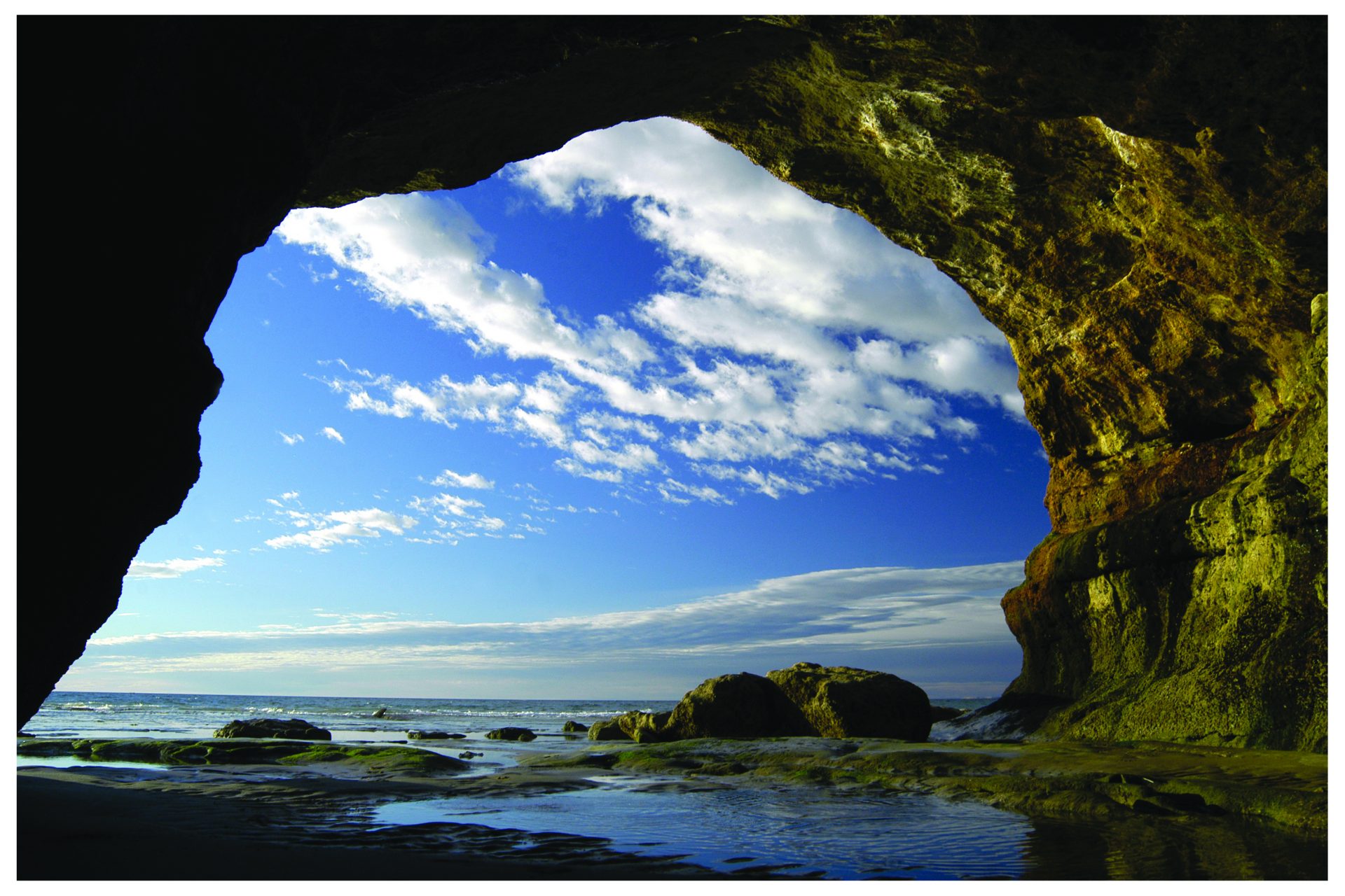
On the other side of the Patagonia, its coast presents a very different and beautiful landscape. In this case, the main attraction is the sea wildlife – abundant both in quantity and variety, with some of the largest colonies in the world – and the possibility to get to “The End of the World”. National Route Nº 3 runs parallel to the shores of the Atlantic coast, beginning at the Plaza Congreso in Buenos Aires and ending at Tierra del Fuego National Park. During its 3063 km, the traveler will be able to enjoy countless attractions related to nature, wildlife, geology and the magic of being at the southernmost point of America, surrounded by mountains and looking over the horizon to the white continent.
The Journey
The first Patagonian city that tourists will find in their trip through Route Nº 3 (Ruta 3) going from North to South is Viedma, capital city of the Province of Río Negro. The seaside town of El Cóndor (Balneario El Cóndor) is located 30 km from Viedma. Its beaches, comprised mainly of low coasts gradually give way when you travel west to the first cliffs; there, you can find the largest colony of burrowing parrots in the world. The vast extensions of sand are filled with resorts and areas specifically destined to doing water and wind sports. A few miles ahead are located the towns of San Antonio Oeste and Las Grutas. The latter of which thrives within the Natural Protected Area Bahía de San Antonio (Área Natural Protegida Bahía de San Antonio) on the coast of the imposing Gulf of San Matías (Golfo de San Matías). The gulf hosts a rich variety of life that can be seen all year round. This can be witnessed in embarked sightings from Las Grutas and San Antonio Este. According to the sighting schedule, the traveler will be able to sail a sea with the presence of dolphins, sea lions, petrels, albatrosses, penguins and, from August through October, the colossal Southern right whale. On top of that, due to its geographical location, the beaches of Las Grutas possess a particularly warm sea, which is why thousands of tourists travel there every summer to enjoy its waters.
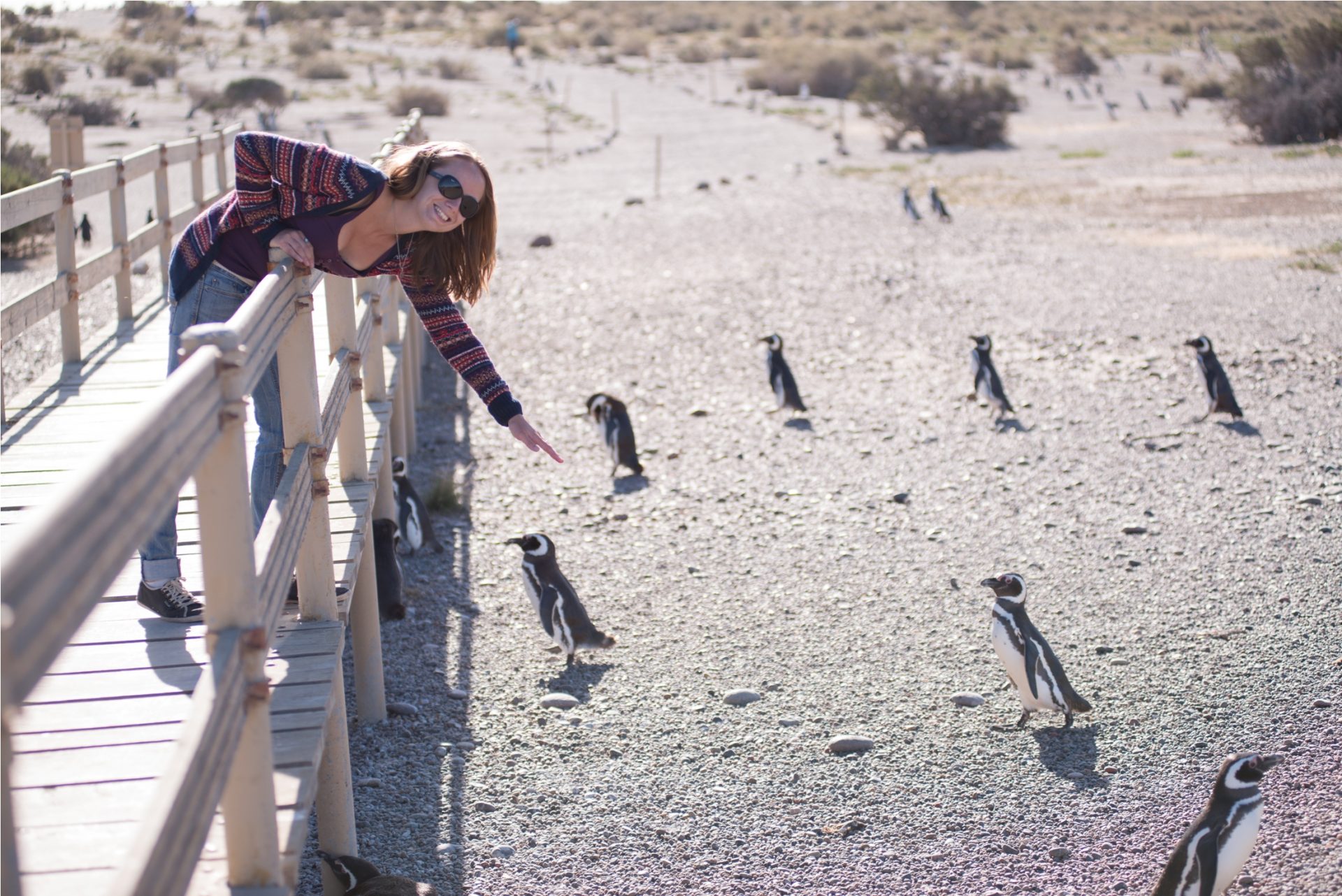
Going further South, once in the Province of Chubut, we’ll arrive to Puerto Madryn, city with an undisputable touristic attractive being the largest service center of the Patagonian coast and entry to the Valdes Peninsula, World Heritage Site of the UNESCO since 1999. This is the scenery chosen by the Southern right whale each year to mate and give birth to its offspring. This natural show can be witnessed between June and mid-December in the town of Puerto Pirámides. Nevertheless, this is not the only species that can be seen on the area, they are joined by dolphins, orcas, Sea lions, sea elephants, Magellanicic Penguins and a great diversity of birds and land fauna. Furthermore, the Natural Protected Area Punta Tombo is the greatest continental reserve of Magellanic penguins with over four hundred thousand specimens which can be seen between the September and April.
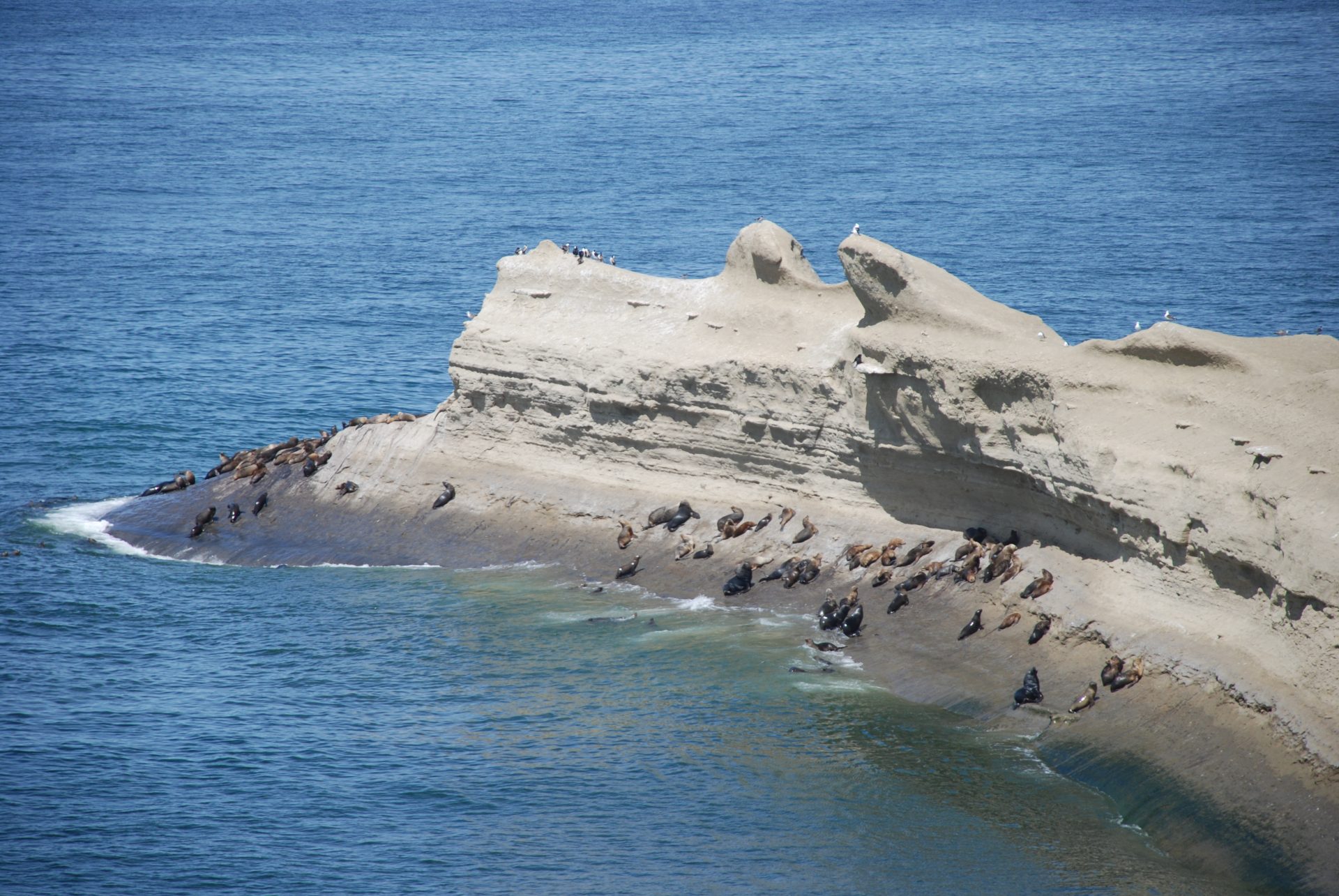
A few kilometres further, we find the beginning of the so called “Blue Route” (Ruta Azul), which starts in the city of Comodoro Rivadavia and ends in the capital city of Santa Cruz. It is a new tourist alley which is traversed by Route Nº 3 (Ruta 3) which has, in over 500 kilometres, several sighting locations of sea lions (of one and two hairs), sea elephants, Commerson’s dolphins, cormorants, sheathbills, Magellanic penguins and it is even possible to see the only continental colony of Southern Rockhopper penguins. This alley connects over six towns in both provinces to end in Rio Gallegos
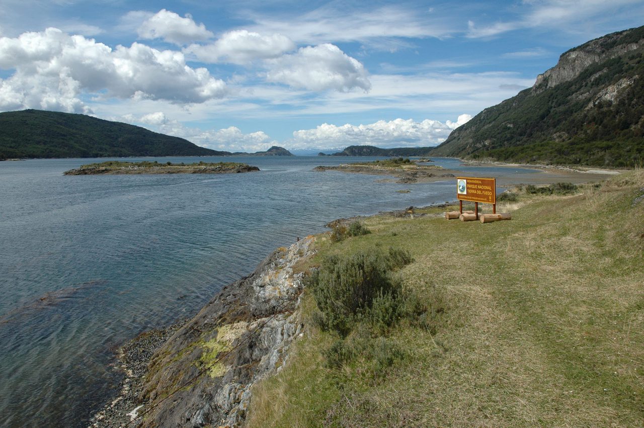
From there onwards, the adventure transforms. The route leaves behind the blue sea filled horizons, to give way to mountainous scenery provided by the Andes in Tierra del Fuego. It must be noted that if you wish to arrive through land, travelers will have to cross through Chilean territory, which means it will be necessary to have all the necessary documents in order to go through migrations. Once in the End of the World, the traveler will be captivated by the almost remote calm of its thick forests, mountains, valleys and lakes that will seduce the sight and fill the imagination of the visitors. Ushuaia is the largest tourist centre of the province. The channels allow the travelers to enjoy an unforgettable experience and a chance to see the amazing natural scenery of the city from another perspective. Beautiful bays, islets, and fiords as well as a wide variety of birds and sea mammals dazzle the eyes of the visitors along the blue waters of the mythical Beagle Channel. One of the must see locations is the Tierra del Fuego National Park, located 11 km from the city; it is the only Argentinean national park with a seacoast (Beagle Channel) bathing the forest.
The Train of the End of the World provides a chance to go back in time to the era in which prisoners were taken by train to provide firewood for the population of the city. Nowadays, the Train of the End of the World has become a tourist attraction which covers the same journey that convicts travelled into the national park. And it will be exactly there, in Lapataia bay that the traveler will have completed its voyage, when he finds a sign announcing the end of National Route Nº 3 (Ruta Nacional 3), exactly 3063 kilometres from Buenos Aires.