First, two trails are suggested that offer a novel approach to short circuits, suitable for the whole family, aimed at exploring and interpreting the natural environment and local culture in spaces linked to protected areas.
Lihué Calel National Park
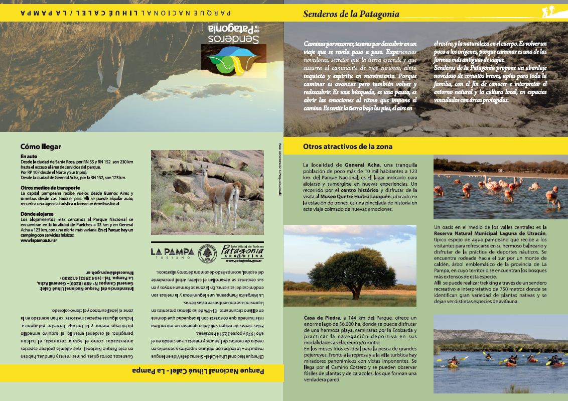
Lihué Calel National Park—Mountains of Life in the Mapuche language—welcomes you with cave paintings and mountain ranges amidst plains and plateaus. It was created in 1976 and covers an area of 32,514 acres.
These volcanic mountain ranges provide a more humid microclimate in contrast to the prevailing climate, which has contributed to the flourishing of a great diversity of local flora. 40% of the species of the province are found in these lands.
The Pampean Daisy is a legume, endemic to the mountains.
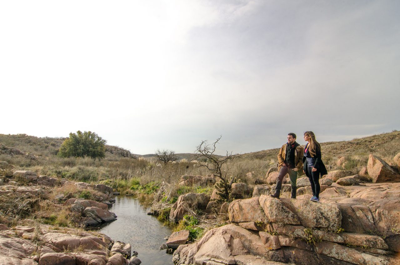
Streams form in the area and the calden, a tree originating from the Espinal region, grows nearby, accompanied by the bull shadow and alpatacos.
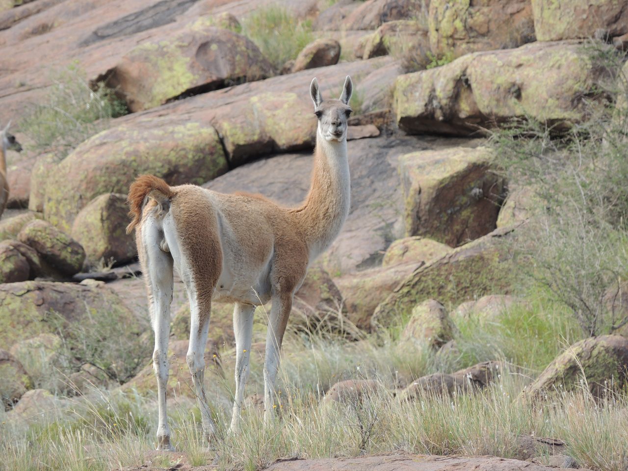
Guanacos, gray foxes, pumas, maras, and rheas inhabit this National Park, which also protects endangered species such as the crowned eagle, peregrine falcon, yellow-backed cardinal, the elusive pink fairy armadillo, and the Patagonian tortoise. Even some invasive species have settled in the area: the European wild boar and the red deer.
HOW TO GET THERE
The capital of La Pampa receives flights from Buenos Aires and buses from almost the entire country.
By car
From the city of Santa Rosa, via National Route 35 and National Route 152 from the Southwest, it is 230 km to the access to the park’s service area.
By Provincial Route 107 from the North and South (gravel).
From the city of General Acha, along National Route 152, it is 123 km.
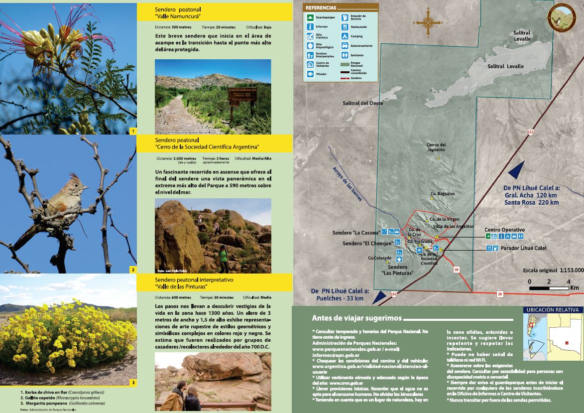
TRAILS
In this scenario, we suggest five easily accessible and easy-to-follow trails, so you can venture out and let yourself be carried away by what the path offers.
1 – Namuncurá Valley pedestrian trail
This short trail, which begins at the campsite, is the transition to the highest point in the protected area.
- Distance: 300 meters
- Time: 20 minutes
- Difficulty: Low
Circuit entry hours: Summer hours: 7:00 a.m. to 5:00 p.m. (November 1st to April 30th). Winter hours: 8:00 a.m. to 3:00 p.m. (May 1st to October 31st).
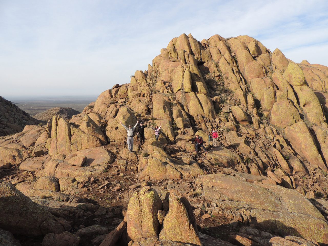
2 – Pedestrian trail “Cerro de la Sociedad Científica Argentina”
A fascinating uphill hike that offers a panoramic view at the highest point of the park, 590 meters above sea level, at the end of the trail.
- Distance: 3,000 meters (round trip)
- Time: approximately 2 hours.
- Trail: Marked with rock stakes.
- Difficulty: Medium-high
Circuit entry hours: Summer hours: 7:00 a.m. to 5:00 p.m. (November 1st to April 30th). Winter hours: 8:00 a.m. to 3:00 p.m. (May 1st to October 31st)
3 – “La Casona” interpretive pedestrian trail
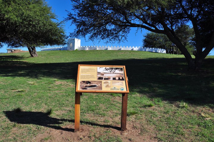
Following this path, you can see the stone and adobe ruins of what was once the “Santa María de Lihué Calel” cattle ranch, a mid-20th-century building with a distinctive castle-like design, including battlements, towers, and a chapel. It was used by the Gallardo family only as a summer vacation spot.
- Distance: 300 meters
- Time: 25 minutes
- Difficulty: Low
The fragile remains of “La Casona” are currently inaccessible, as work is underway to improve its conservation and visitor conditions.
4 – “El Chenque” interpretive pedestrian trail
This transitional section between the cattle ranch house and the “Valle de las Pinturas” describes the work of archaeologists within the Park and provides insight into the lives of those who traveled through these places.
- Distance: 250 meters
- Time: 20 minutes
- Difficulty: Low
5 – “Valle de las Pinturas” interpretive pedestrian trail
The steps lead us to discover vestiges of life in the area 1,300 years ago. A 3-meter-wide and 1.5-meter-high eave displays rock art depictions of complex geometric and symbolic styles in red and black. It is estimated that they were created by hunter-gatherer groups around 700 AD.
- Distance: 600 meters
- Time: 30 minutes
- Difficulty: Medium
GENERAL TIPS
Before traveling, we suggest:
There is no entrance fee to the National Park. Check season and hours.
Lihué Calel National Park Intendancy: Balcarce 933
02952 41-6213 – E-mail: lihuecalel@apn.gob.ar
For inquiries and reservations, please send a message via WhatsApp to +54 2954 68-4228
National Parks Administration: Headquarters – Carlos Pellegrini 657, CABA
(“Ciudad Autónoma de Buenos Aires” – Self-Governed City of Buenos Aires). Tel: (+54 11) 3985 – 3800 Int. 11010 – E-mail: informes@apn.gob.ar
https://www.argentina.gob.ar/interior/ambiente/parquesnacionales/lihuecalel
- Check road conditions: www.argentina.gob.ar/vialidad-nacional/atencion-al-usuario
- Wear comfortable and appropriate clothing according to the time of year: www.smn.gob.ar
- Bring basic supplies. Remember that the water is not suitable for human consumption.
- Considering this is a natural area, there are snakes, arachnids, and insects in the area. It is recommended to bring repellent and follow the signs.
- Bring binoculars
- There may be no phone signal or Wi-Fi network.
- Get advice on trail difficulty. Inquire about accessibility for people with motor or sensory disabilities.
- Always notify the ranger before starting any trail by registering at the Information Office or Visitor Center.
- Never walk outside the permitted trails.
OTHER ATTRACTIONS TO DISCOVER IN THE AREA
The locality of General Acha, a quiet village of just over 10,000 inhabitants 123 km from the National Park, is the perfect place to stay and immerse yourself in new experiences. A tour of the historic center of General Acha and a visit to the Quetré Huitrú Lauquén Museum, located in the train station, is a touch of history on this trip filled with new emotions.
The “Laguna de Utracán” Municipal Nature Reserve is an oasis in the middle of the central valleys. It is a typical Pampas water body that welcomes visitors to refresh themselves in its beautiful spa resort and enjoy water sports. It is surrounded to the south by a calden forest, a tree characteristic of the province of La Pampa, which boasts the largest number of specimens within.

There you can go trekking along a 750-meter recreational and interpretive trail where you can identify native plants such as olivillo, piquillin, blond mallow, pennyroyal, and bull shadow, and you can also see different species of birds such as rheas, martins, yales, etc.
Casa de Piedra, 144 km from the park, offers a huge lake where you can enjoy a beautiful beach, hike along the “Ecobarda,” and practice recreational boating in the following forms: sailing, rowing, and/or motorboating.
In the cold months, it is ideal for fishing for large silversides. Facing the dam and the tourist village, there are panoramic viewpoints with breathtaking views. Access via the Coastal Road, you can see plant and snail fossils, which form a veritable wall.

WHERE TO STAY
The closest accommodations to the National Park are located at the town of Puelches, 33 km away, and at General Acha, 123 km away, with a more varied offering. There is a campground within the park with basic services.
https://prestadoresturisticos.lapampa.gob.ar/public/alojamientos
OTHER TRAILS TO CONTINUE DISCOVERING LA PAMPA
“Parque Luro” Provincial Reserve
The “Parque Luro” Provincial Reserve is located 35 km south of the city of Santa Rosa. It is a 7,600-acre protected area that preserves the ecosystem of the calden forest, a characteristic tree of La Pampa. Nature offers three natural environments here: the forest, the lagoon, and the dune, home to a great diversity of flora and fauna. Activities offered here range from historical, cultural, and naturalistic.
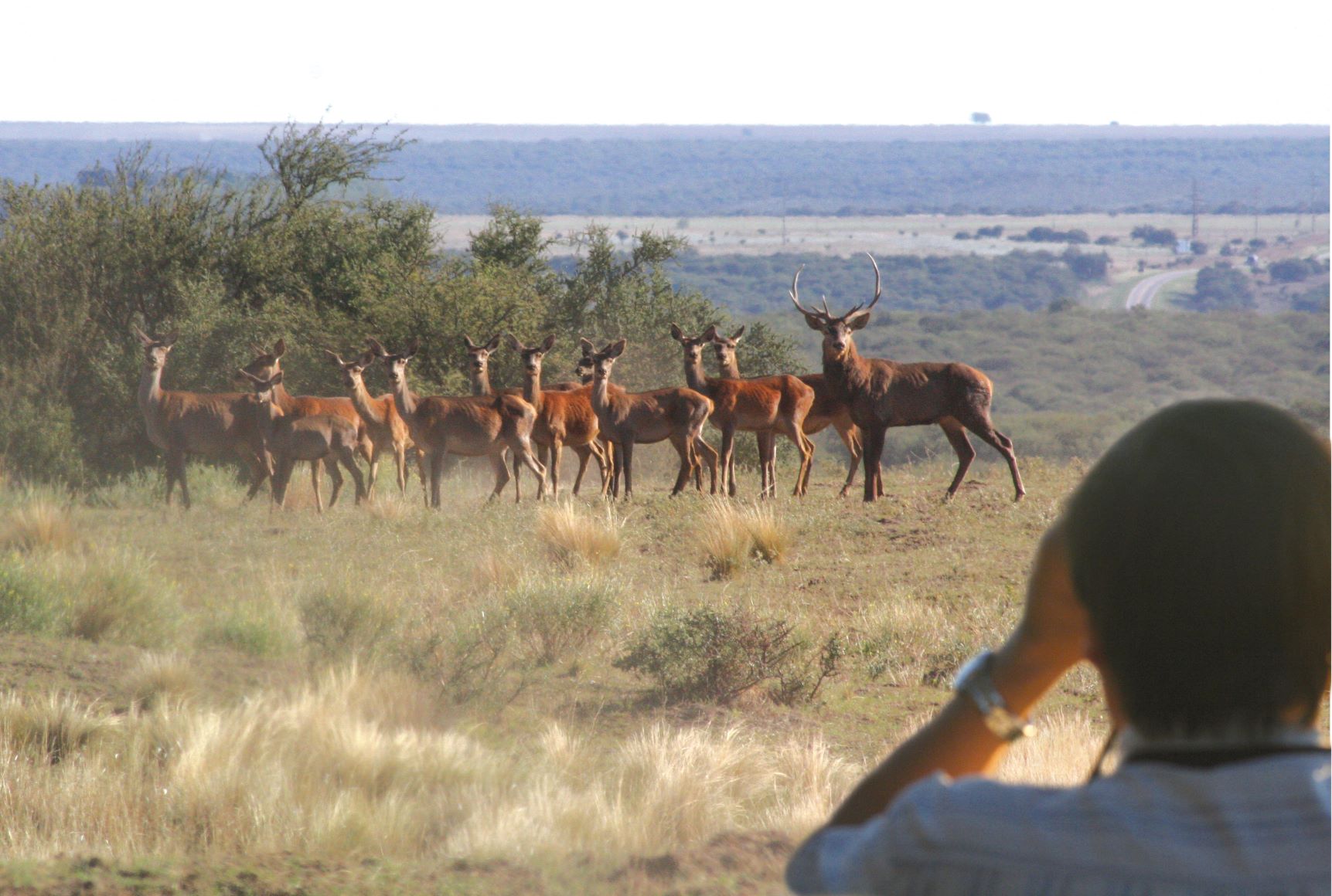
At the beginning of the 20th century, Pedro Olegario Luro decided to establish a hunting reserve here in the middle of the forest, the first in the country, called “San Huberto” (patron saint of hunters), a place where the first European red deer and wild boar were introduced to Argentina.
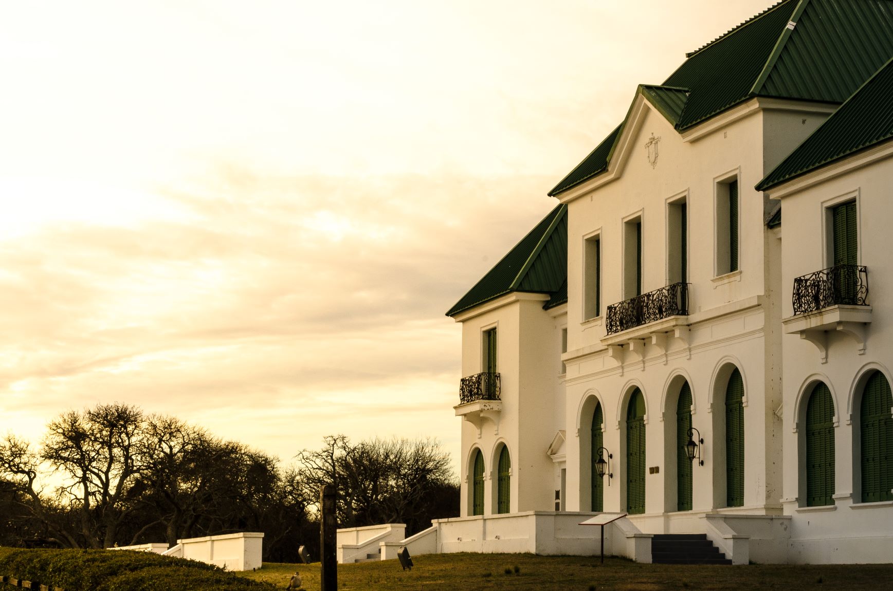
One of the Reserve’s main attractions is an old mansion, now the “El Castillo” Museum, the construction of which began in 1905 and still preserves the original design and furnishings of its first owners: Pedro Olegario Luro and Antonio Maura.
The property also has a carriage room with 15 vintage vehicles.
The “Parque Luro” Provincial Park Reserve welcomes its visitors from Monday to Friday from 9 a.m. to 6 p.m. Saturdays, Sundays and holidays from 10 a.m. to 6 p.m. (winter hours). In summer, check hours at https://turismo.lapampa.gob.ar/visitas-a-la-reserva-natural-parque-luro.html
In terms of services, it has a camping area, cabins, a swimming pool, a restaurant, and a grocery store.
During March and April, you can enjoy a unique natural spectacle, exclusive to the province of La Pampa: the sighting of rutting deer. The red deer prepare to fight to form and maintain their harem of females. Guided tours to viewing points are available.
The reserve has four trails of varying lengths and low difficulty. Following them allows you to admire nature in all its splendor and in a unique environment. As you enter the forest, you can see pumas, deer, wild boars, and foxes. In total, more than 160 species of birds can be spotted.
Dune Trail
This trail leads to the highest point in “Parque Luro,” the panoramic point, offering a beautiful view of the entire reserve. It is 2,200 meters long and can be completed in approximately one hour. It leads to the Hermitage of the Virgin of Luján and allows you to see the Million Tanks, a large pond that supplies the park’s water.
Forest Trail
This trail is about 1,500 meters long and takes approximately one hour to complete. During the hike, you can admire the beauty of the calden tree, with the possibility of spotting red deer, wild boar, the occasional rhea, and many small birds.
Lagoon Trail
This is the longest trail, 2,700 meters long, and combines the forest with the lagoon or saline lagoon. Along the way, you can observe some curious and elusive animals. The trail has two rest stops. It is recommended to bring binoculars or a camera with a good zoom to observe animals from the shore that wade through the salt mud, such as deer and wild boar, as well as wading birds.
Pampas Poets Trail: Along a 1,000-meter path through the highest forest in the protected area, you can learn about the main poets of the province of La Pampa, with excerpts from their most important works.
Descent to the saline lagoon: This 800-meter trail starts at the interpretation center and ends at the lagoon. It slopes gently toward the low salt flats, at which a wide variety of native birds and flora can be observed.
“Parque Luro” Contact:
Tel. (02954) 452600 – Internal numbers 1946 and 1947
Mail: infoparqueluro@gmail.com
Other options for enjoying hiking in the Pampas landscape include:
“Laguna de Utracán” Municipal Nature Reserve
Located 15 km from the city of General Acha, along National Route N° 152, up to the intersection with Provincial Route N° 9, with asphalt access.
The Reserve covers a surface area of 11 acres, within which lies the “Laguna de Utracán” saline lagoon. 142 species can be observed there.
Interpretive recreational trail::
It extends 750 meters with a moderate decline. It encompasses the three typical environments of La Pampa: the dune, the calden and chañar forest, and the salt lake forest. Its average height is 252 meters above sea level. 17 native plants specific to each environment can be identified, with the transformations they produce in said environments.
General Acha Information Center: National Route No. 152 Km. 28 turismo@generalacha.gob.ar Cellphone: (2952)-402006 (2952) 412315
“Camino del Agua” Trail. This interpretive trail can be enjoyed near the town of La Adela, located in the southeastern Pampas region. The trail is 2 km long and is located within the archaeological site of “Cerro de Los Viejos,” a rocky outcrop with a maximum height of 216 meters above sea level. Its characteristics transformed it into a space used by pre-Hispanic inhabitants to meet their needs, primarily those related to water.
Delfín Pérez Recreational Park. Located at the city of General Pico, 5 km from the city center, it features a lagoon with a surface area of approximately 150 acres, an average depth of 4 meters, and a surface area of 100 acres. Water sports activities such as canoeing, water skiing, and windsurfing are available. Fishing for silversides, carp, and catfish is also available. Along the way, numerous bird species can be observed.