Trail 1 – Sierra Grande
Guided hikes along the trails and climbs of Sierra Grande. Medium-difficulty trails in the mountains surrounding the city of Sierra Grande, with a guide. Contact: Sierra Grande Tourism Office
Trail 2 – “Cerrito Llao Llao” and Villa Tacul – Bariloche
A very pleasant walk through the forest, with stunning landscapes and an unparalleled view from the viewpoint of “Cerro Llao Llao.” Once there, you can continue to Villa Tacul and enjoy its beaches, ideal for diving and spending a beautiful afternoon.
- Starting point: “Circuito Chico,” 1300 meters from Puerto Pañuelo and the Llao Llao Hotel.
- Duration: Between 50 minutes and 1.2 hours. From the starting point to “Cerro Llao Llao”: 1 hour and 10 minutes. To Villa Tacul: 50 minutes if you go from the viewpoint of Llao Llao, otherwise, 1 hour and 20 minutes.
- Difficulty: Low (it has some slopes that may be difficult for older people).
Trail 3 – “Bahía López” – Bariloche
A simple and pleasant hike, ideal for beginners. It offers spectacular views of “Brazo de la Tristeza,” “Bahía López,” and the eastern side of “Capilla” hill.
- Starting point: Parking lot of the Alun-Nehuen Hotel, in “Bahía López.”
- Duration: 1.30 hours
- Difficulty: Low
Trail 4 – “Lago Escondido”
A beautiful route which consists of two trails that can be combined as an alternative hike: “Lago Escondido” and “Puente Romano.” The first takes you through the Coihue Forest, with its characteristic natural tunnel formations, and continues to the lake, which is notable in summer for the pleasant temperature of its warm waters. From there, you can continue to “Bahía de los Troncos,” from where you can enjoy incredible views of “Cerro López”, “Cerro Capilla”, the mouth of “Bahía López”, and the headwaters of “Brazo Tristeza”
Meanwhile, the trail to “Puente Romano” is a pleasant, short walk that leads to an old stone bridge built by the National Parks in 1937.
- Starting point: Playground located in front of the Ranger’s House.
- Duration: 20 minutes (one way to “Lago Escondido”).
- Difficulty: Low.
Trail 5 – Crossing the four shelters – Bariloche
This is an Andean trek that connects the Frey, Jakob, “Laguna Negra,” and López refuges. A trail for those seeking a physically and technically demanding experience. Overnight stays are provided at the refuges, which provide dinner and breakfast. This trek can also be completed part-way.
- Duration: 4 or 5 days.
- Difficulty: High.
- Walking time per day: between 4 and 9 hours.
Trail 6 – “Cerro Tronador,” “Pico Argentino” – Bariloche
At 3,554 meters above sea level, “Cerro Tronador” is the highest elevation in Nahuel Huapi National Park. From its summit, you can enjoy an incomparable view. It is also an excellent opportunity to practice high-altitude climbing. Bring an ice axe and crampons.
- Duration: 3 days.
- Difficulty: Medium/high.
- Walking time per day: between 6 and 12 hours.
Trail 7 – Double Crossing of the Andes – Bariloche
A journey through the history and culture of an entire people. South of “Cerro Tronador,” explore the legendary Vuriloche Crossing, retracing the path of the legendary Jesuit route, once used to reach Lake Nahuel Huapi. During the tour, visit villages that live self-sustaining, as well as hot springs and places few tourists can access. Crossing into Chile, you will reach a picturesque town called Cochamó. Returning through the mountain range to Paso El León, you will encounter the Manso River, filled in its middle reaches with rapids and waterfalls that belie its name.
Paso Córdoba Protected Natural Area and Red Moon Valley
The Paso Córdoba Protected Natural Area is located 12 km from the city of General Roca and is accessed via provincial route N° 6 south of the “Negro” river. Its extensive area offers a variety of environments with distinctive flora and fauna.
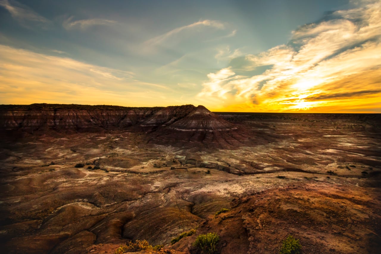
At the entrance to the Paso Córdoba Protected Natural Area, you can choose from a variety of trails clearly marked on the entrance sign. The trail markings offer the possibility of combining motorized and pedestrian excursions, such as the Nautical Club and the “Lagunitas” area, the Virgen Misionera trail, canyons, “Tres Cruces” viewpoints, and Red Moon Valley, which is undoubtedly the most popular spot for residents and tourists.
The Red Moon Valley offers a reddish landscape with vegetation typical of this type of clayey soil, predominantly containing hematite; from higher vantage points, the surrounding landscape can be seen, including the city, the ranches sector, the riverbed, and the main plateau to the south. Foxes and maras are common, as well as birds such as vultures and small mountain birds. Due to its high sensitivity to erosion, only hiking is permitted at this site. In addition to its present-day landscape, the Moon Valley is highly valued for its paleontological value.