CHUBUT
Trails at “Los Alerces” National Park
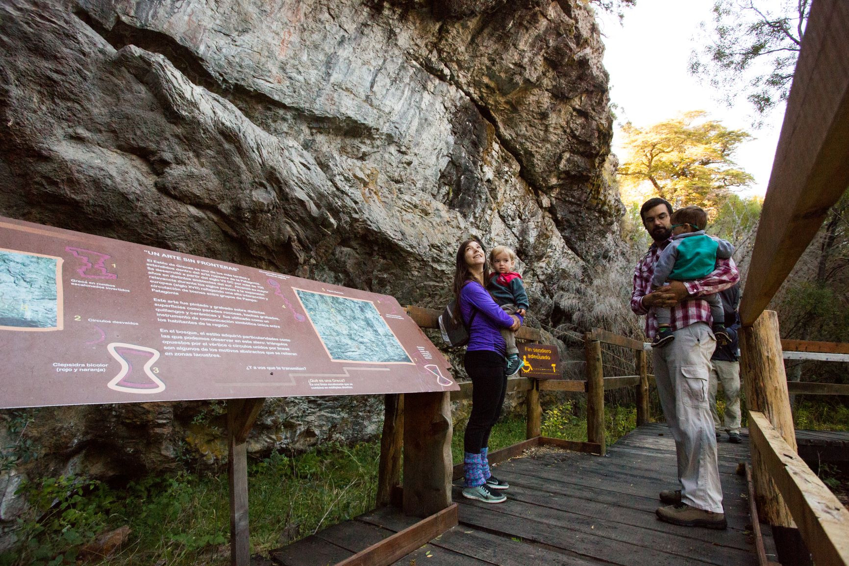
Cave Paintings (Central Zone): Two and a half kilometers from Villa Futalaufquen, you can see an overhang with cave paintings from ancient settlements, then take a ten-minute climb to a viewing point. It takes forty minutes and is of low difficulty.
“Laguna Larga” (Central Zone): Two kilometers from the information center, along a vehicle path, you travel four kilometers to reach the lagoon outside the park. It takes four hours and is of medium to low difficulty.
“Alto el Petiso” (Central Zone): Starts at Puerto Mermoud on the shores of “Lago Verde.” The hike continues through a forest on a snail-shaped climb to reach “Arroyo Zanjón Hondo.” Continue along the streambed to a ridge, along which you ascend to the scree that leads to the summit. Total hike: 7 hours. Difficulty level: High. Registration at the ranger section at the Arrayanes River is required (before 10 a.m.).
“Cerro Cocinero” (Central Zone): It begins 150 meters from the Rañinto stream. It climbs a steep slope until reaching a high valley. One-way time: 4 hours. Total hike: 7 hours. Difficulty: High. You must register at the National Parks section – Central Entrance. (Before 10 a.m.)
Irigoyen Waterfall (Central Zone): Six kilometers from Villa Futalaufquen, a large waterfall cascades through lush and varied vegetation. The first section lasts fifteen minutes and is of low difficulty.
Lake Krugger (Central Zone): It begins at 1,500 meters past Puerto Bustillo. This is the most challenging trail in the park, as it requires more time. Before starting this hike, you should check the trail status, available sections, and register at the information center. Each section takes approximately 6 or 7 hours to complete, carrying light weight. Camping is permitted at “Playa Blanca,” but fires are prohibited. There is a park ranger station at Lake Krugger. Difficulty: high.
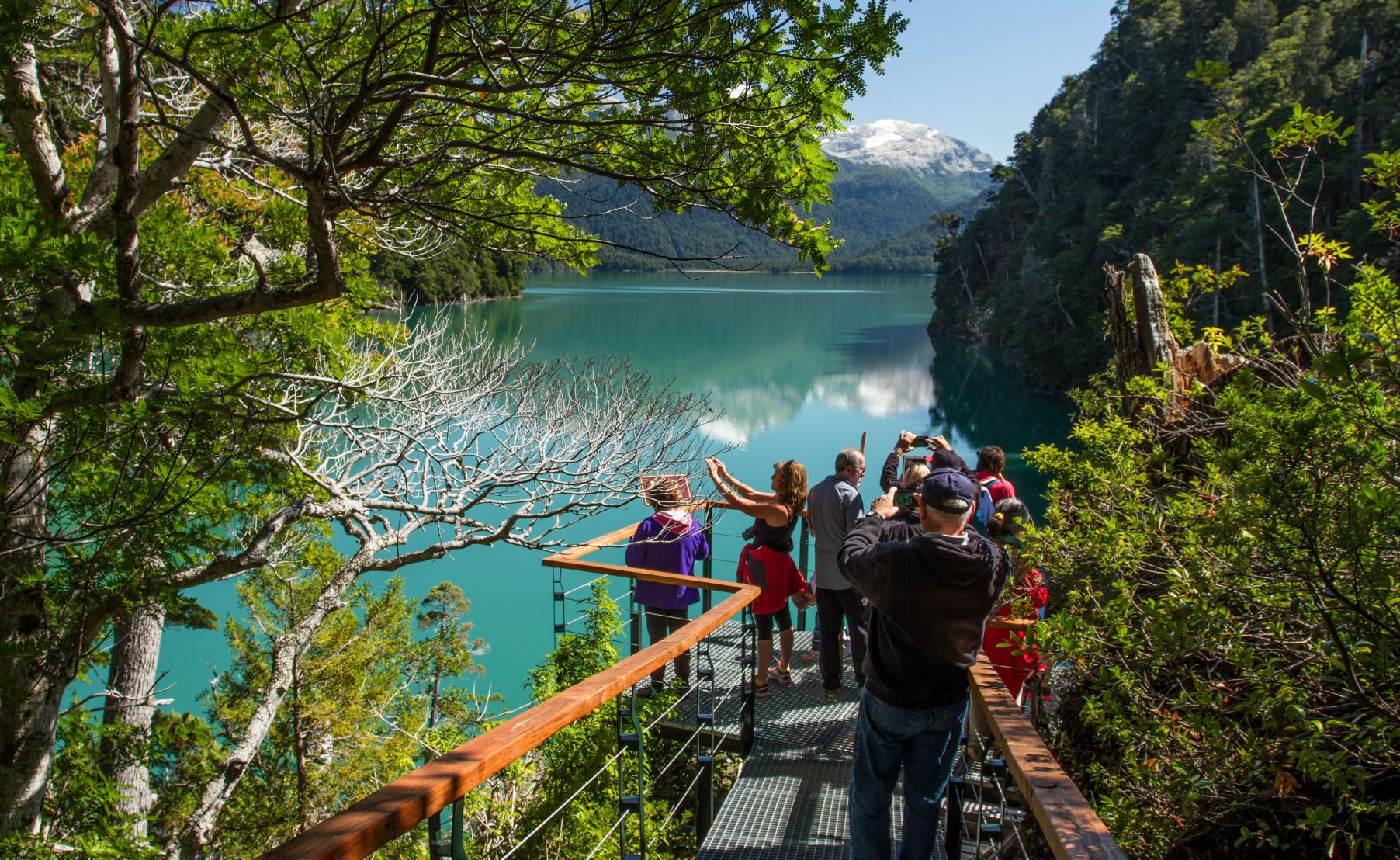
“Lago Verde” (Central Zone): It begins 1 km from the “Lago Verde” section. At the end of the trail, you have an excellent panoramic view of lakes “Lago Verde,” Rivadavia, and Menéndez. It lasts one hour and is of medium to low difficulty.
“Laguna Escondida” (Central Zone): It starts in front of the “Arrayanes” River Section and ascends to the Lagoon. Registration is required and the hike takes three hours. Its difficulty level is medium.
“Arroyo del Hacha” Waterfall (North Zone): It begins 200 meters from Lake Rivadavia. You reach a large waterfall and can enjoy panoramic views of Lake Rivadavia and its surroundings. It takes one hour and is of medium to low difficulty.
“Laguna del Toro” (South Zone): It begins 600 meters from the South Gate of the “Los Alerces” National Park along the paved road. It begins with a slope through the forest, passes through a rocky area, and reaches a high-altitude lagoon with spectacular views of Lake Amutui Quimey. The total hike takes 5 hours. Difficulty: Medium. Registration required at the Parks section – South Gate.
Futaleufú Dam Interpretive Trail (South Zone): It begins 600 meters from the south entrance of the “Los Alerces” National Park along the asphalt road. It is a short walk with interpretive signage about the dam construction process. The walk takes 30 minutes. Low difficulty.