SANTA CRUZ
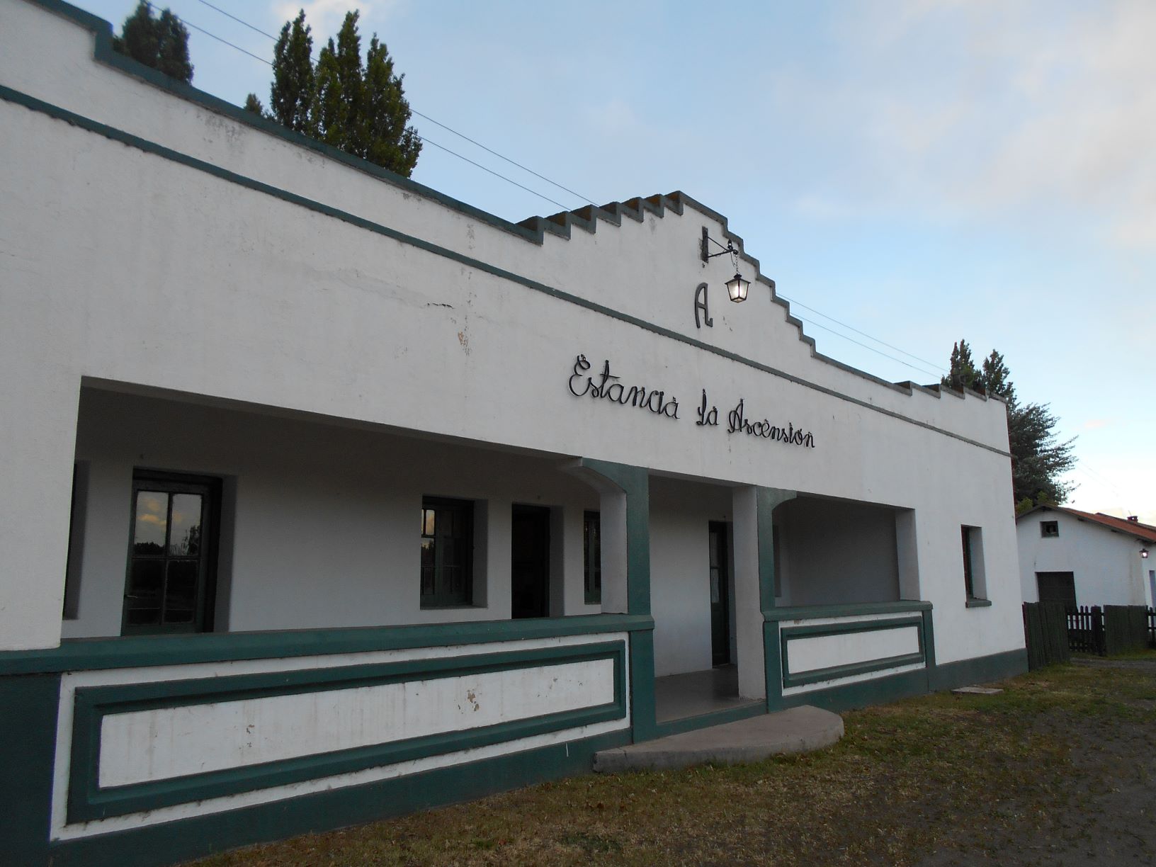
“La Ascención” Portal: “Parque Patagonia” Circuit – Patagonia National Park.
It is located in the northwest of the province, between the towns of Los Antiguos (20 km) and Perito Moreno (40 km) and on the shores of Lake Buenos Aires. It has numerous trails with different levels of difficulty that invite you to experience the natural and cultural beauty of the place. You can also spot the spectacular native fauna of the region, such as guanacos, foxes, skunks, choiques, condors, and hundreds of birds, and perhaps the tracks of a puma. “La Ascención,” which covers 20,000 acres from the lake to the Lake Buenos Aires Plateau, is open to the public free of charge to promote nature tourism throughout the “Parque Patagonia” Binational Circuit.
Historic Center and path to the lake
The cattle ranch’s historic center includes the old school converted into a visitor center, the renovated circular “matera,” and the sheep shearing shed, which now houses a cultural center. From there, the Trail to the lake begins, providing access to the shores of Lake Buenos Aires and a service area with public fire pits after passing through galleries of ancient willows and poplars. Continuing to the right and left for 800 meters leads to different environments and views.
- Duration: 45 min. one way.
- Length: 1.5 km.
- Difficulty: Low.
The Moon’s Trail
A spectacular viewpoint overlooking the lake from a high cliff. You can descend to the shore, observing strata containing volcanic material from ancient eruptions. The beach is ideal for walking on calm days. You can appreciate the native flora, including ancient specimens of blackthorn (Colletia histryx), unique to the southern shore of the great lake. Access is on foot from Route 43 (7 km east of the Los Antiguos police checkpoint
- Duration: 50 minutes.
- Difficulty: Low. The return from the coast requires an ascent up a sandy slope.
- Length: 2.2km.
Download the trail brochure at the following link:
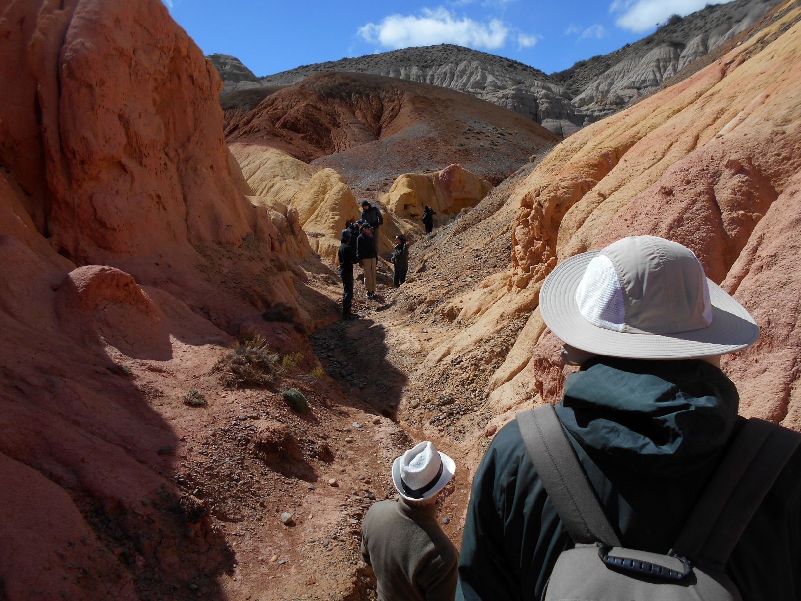
Pinturas River Canyon Portal – “Parque Patagonia” Circuit.
It is located on National Route 40, 57 km south of Perito Moreno and 74 km north of Bajo Caracoles. A network of 16 km of trails offers the opportunity to hike, go on photo safaris, and spot wildlife such as guanacos, red foxes, lizards, skunks, choiques, Andean condors, hundreds of bird species, pumas, and the endemic orange-browed chinchilla. Along the way, you can see imposing cliffs, panoramic views of the Andean foothills, vibrantly colored lands, deep canyons, and eaves with cave paintings.
“Tierra de Colores” Trail
It offers a trail through a canyon with irregular walls and gradient pastel colors. You cross a small plateau to reach a viewing balcony that offers a view of the vast landscape. Fossil fragments have been found in this area, such as the molars of primates, vertebrates that inhabited the region during the Tertiary or Cenozoic era, some 65 million years ago.
- Duration: 1h 45 min (round trip).
- Length: 4.8 km (round trip).
- Difficulty: Low.
“La Guanaca” Trail
After a hike, you ascend to “Cerro Amarillo,” which offers an elevated view of the Pinturas River Canyon.
- Duration: 1h 45 min (round trip).
- Length: 3.8 km (round trip).
- Difficulty: Medium.
Download brochure at the following link:
http://www.parquepatagoniaargentina.org/files/canadon-folleto-esp.pdf
“Perito Moreno” National Park
Located in the center-west of the province, 220 km northwest of the town of Gobernador Gregores. Covering an area of 126,830 acres, the park is of high scientific value due to the discovery of paleontological remains and the biological elements it protects.
Belgrano Peninsula Nature Trail:
It begins at the Lake Belgrano isthmus and runs through the steppe-forest transition area. Approximate duration: 2 hours.
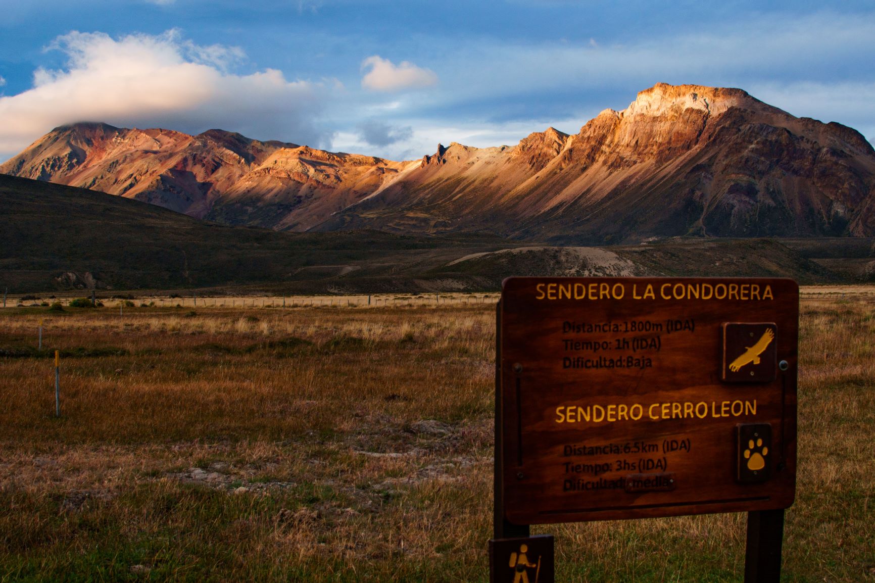
Ascent of “Cerro León”
It begins at the “La Oriental” Cattle Ranch and the round trip takes approximately 4 hours. It offers panoramic views and the chance to observe condors in flight.
“El Chaltén”
A small town known as the National Trekking Capital of Argentina, it extends north of Lake Viedma and El Calafate (214 km), at the foot of “Cerro Fitz Roy.”
“Mirador de los Cóndores” & “Mirador de Las Águilas” Trails
It offers panoramic views of the town of El Chaltén and the mountain ranges Fitz Roy and “Torre”. This easy hike introduces the Patagonian landscape.
- Duration: 2 hours.
- Length: 3 km (round trip).
- Difficulty: Low.
“Chorrillo del Salto” Trail
This is one of the most accessible and popular hikes in the area of El Chaltén, ideal for those short on time or looking for a peaceful walk amidst the Patagonian wilderness. The trail leads to a beautiful waterfall approximately 20 meters high, surrounded by native forest and rock formations typical of the region.
The trail begins just outside the village and can be done on foot or by car, making it an excellent option for all ages and fitness levels. It is especially recommended for families, older adults, or travelers looking for a short, scenic hike.
- Estimated duration: Approximately 1 hour (one way) walking at a leisurely pace and 15 minutes by car.
- Total distance: 3 km kilometers.
- Type of trail: low difficulty, with little elevation change and well signposted.
“Capri” Lagoon Trail
This trail passes through lenga forests and offers stunning views of “Cerro Fitz Roy.” The “Capri” campsite is located here, a popular spot for camping and enjoying the tranquility of the surroundings.
- Duration: 3-4 hours.
- Length: 8 km (round trip).
- Difficulty: Medium – high.
“Torre” Lagoon Trail
It leads to the lagoon located at the foot of “Cerro Torre,” passing by the “Cerro Torre” Viewpoint and the “De Agostini” campsite. It is common to spot icebergs floating in the lagoon.
- Duration: 6-7 hours.
- Length: 18 km (round trip).
- Difficulty: Medium – high.
“De los Tres” Lagoon Trail
The trail to “De los Tres” Lagoon is the most classic and sought-after hike in El Chaltén, offering unparalleled views of “Cerro Fitz Roy,” reflected in the glacial waters of the lagoon. It is a challenging but deeply rewarding experience for any mountain and nature lover. The trail passes through forests, streams, viewpoints, and campsites, until reaching the final viewpoint: a picture-perfect view of the Fitz Roy massif, accompanied by the Poincenot and Saint-Exupéry peaks, with the turquoise lagoon in the foreground.
- Duration: 8 hours.
- Length: 20 km (round trip).
- Difficulty: High.
“Loma del Pliegue Tumbado” Trail
It is an unforgettable experience for those seeking panoramic views and a challenging hike. Unlike other trails that cross valleys and forests, this one ascends an open hillside, offering a completely different view of El Chaltén’s landscape. Along the way, you will get spectacular views of Fitz Roy and “Torre” hills, the “Torre” Lagoon, the glaciers of “Los Glaciares” National Park, and even Lake Viedma and the “Río de las Vueltas” Valley. On clear days, the view from the summit is 360°, one of the best in the area.
- Duration: 10 hours.
- Length: 24 km (round trip).
- Difficulty: High.